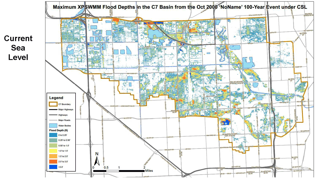
The NoName storm in 2000 was chosen for modeling. In south Florida it was a heavy rainfall event with no storm surge. The model scenarios show how much flooding would have increased had the sea level been higher.
Note the impact of higher water levels on El Portal and the Larchmont area on the right side of the map.
Scenario and approximate year according to 2015-Compact-Unified-Sea-Level-Rise-Projection.pdf using USACE High curve (p. 7)