notes on using the National Hurricane Center's web site

return to Unofficial weather and water info for El Portal https://c7riochico.net/epw/

you can click on most images to see full size, then browser back button to return

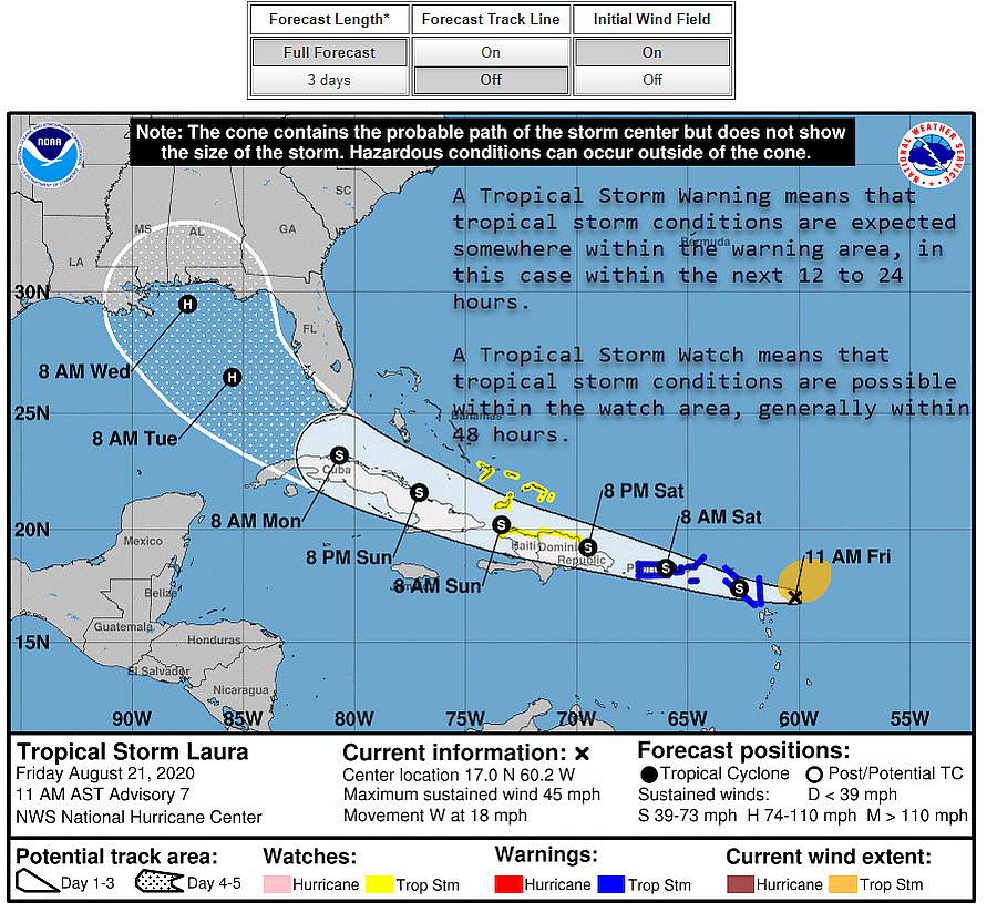
Notes on using the National Hurricane Center's web page and the main forecast advisories there done four times a day. Note that the forecast shows a definite path and timing for a storm but forecasts are always probabilistic estimates. Future weather conditions are never certain so forecasts project what is likely to happen and the probability 
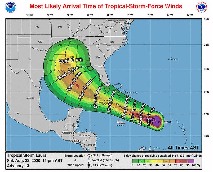
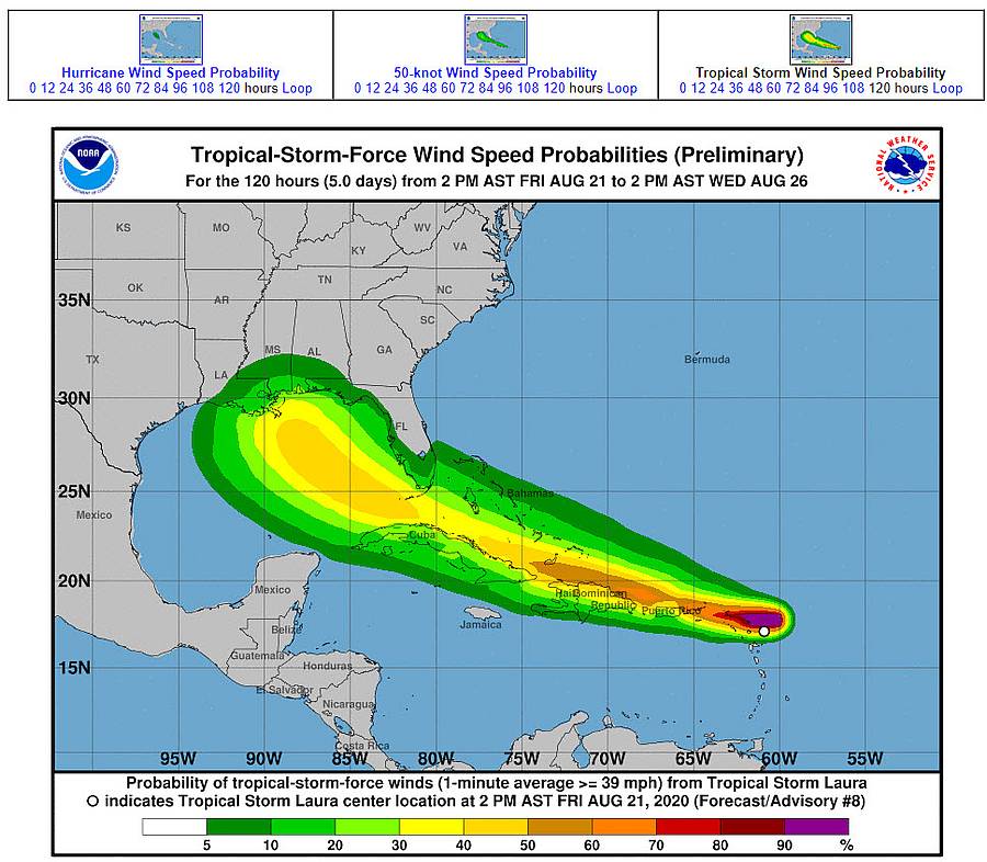
that and other outcomes. Sometimes an estimate is of what is most likely to happen and other estimates are of when the "earliest reasonable time" something might happen. Other estimates give percent chances of different For some purposes an estimate of when a storm is mostly likely to hit is useful, but if you wait until then to go to a safe place, you may be too late. Evacuation decisions are always based on the "earliest reasonable" time a storm might hit which assumes 90% chance that the storm will not have arrived yet.

The images here are some on the NHC site showing the current progress of storm Laura. If you are not familiar with the site you can use them and the notes here to start finding your way around it.

When a storm gets close to south Florida you will also want to go to the Miami-South Florida Weather Forecast Office National Weather Service site.

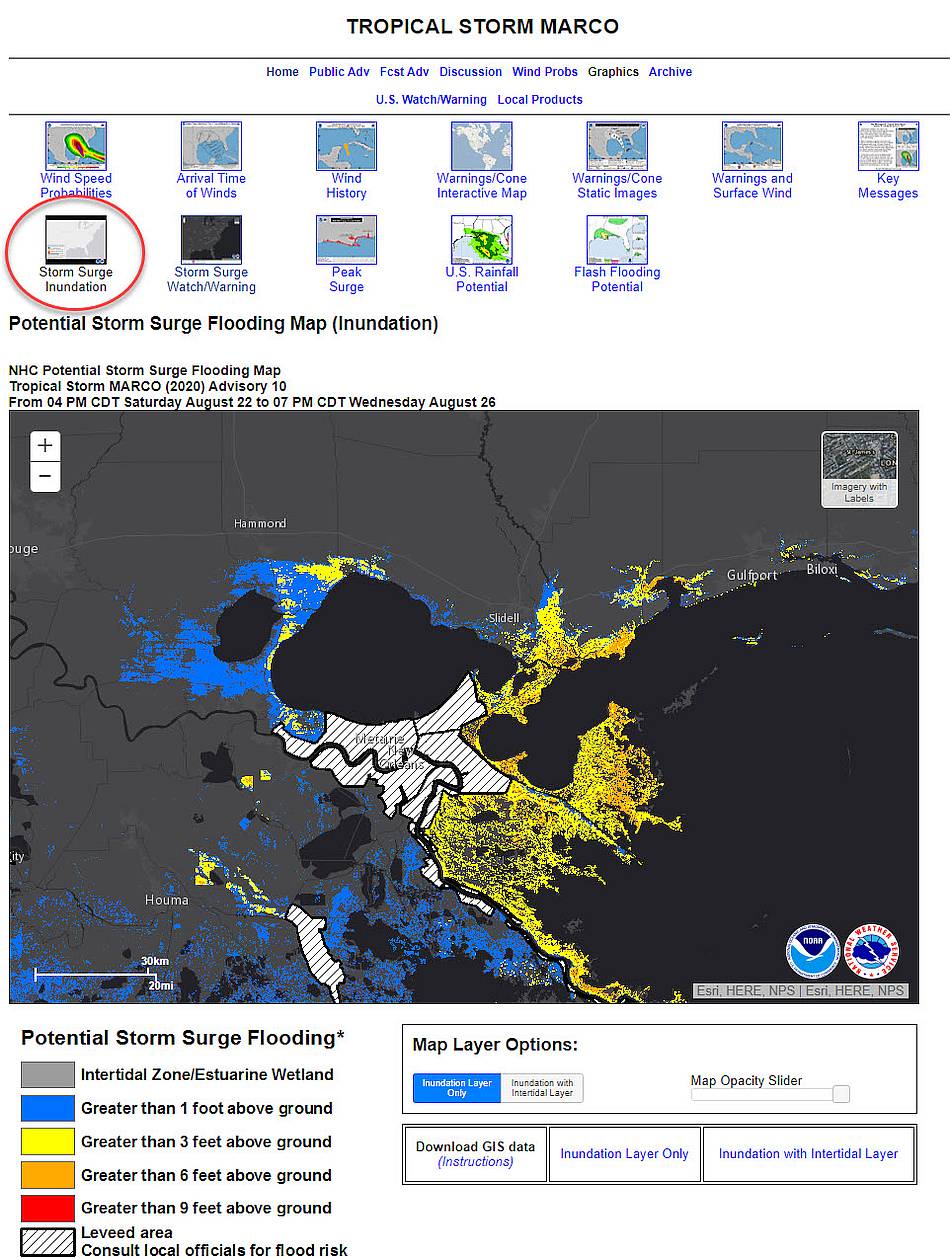
The image below shows what you will see when you get to the NHC site and some of the many things there important for finding about the current forecast. When a storm gets closer to us (e.g. 48 hours away) more information appears on the page such as the storm surge forecast. click to enlarge

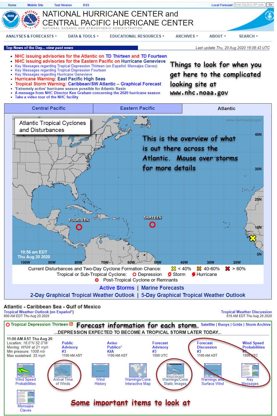
"Key Messages" summarizes the most important things to consider in planning to get ready for this storm. "Forecast Discussion" is a a more technical discussion of the meteorological considerations that went in to this forecast.

Warnings/Cone Static Images
This is the often misunderstood "cone of uncertainty." The forecast shows a specific track for the storm but in actuality the storm could go elsewhere. The NHC uses data from error in past hurricane forecasts to see how much error we might expect for this storm. Based on that there is about a 65% chance the center of the storm will be somewhere in the cone. Note that if we are outside the cone but near to it there still is some chance of getting hit.

click to enlarge

Most Likely Arrival Time of Tropical-Storm-Force Winds
This graphic shows when the storm's tropical storm force winds are most likely to get here according to the forecast. For deciding on when to complete final preparations choose the "earliest reasonable" time for arrival of tropical storm force winds.
This and other graphics have controls like these.

Wind Speed Probabilities
This graphic shows the probabilities of three different wind speeds of a tropical storm happening at different locations. At the top you can choose among the chances of hurricane wind (over 73 mph), over 58 mph wind, or tropical storm wind (39-58 mph). The screenshot shows tropical storm wind. Miami is in an intermediate green color indicating that the current forecast is for between a 10% and 30% chance of Miami experiencing tropical storm wind in this storm.


click to enlarge

Potential Storm Surge Flooding Map (Inundation)
Tropical Storm Marco will probably soon become a hurricane and is now within 48 hours away from New Orleans. This is soon enough that the NHC's high resolution storm surge model can begin to generate a forecast of near-worst-case* storm surge amounts. Use this opportunity to learn how this graphic's controls work.


click to enlarge
* values indicate the water height that has about a 1-in-10 (10%) chance of being exceeded.