return to IPOR hurricane links page
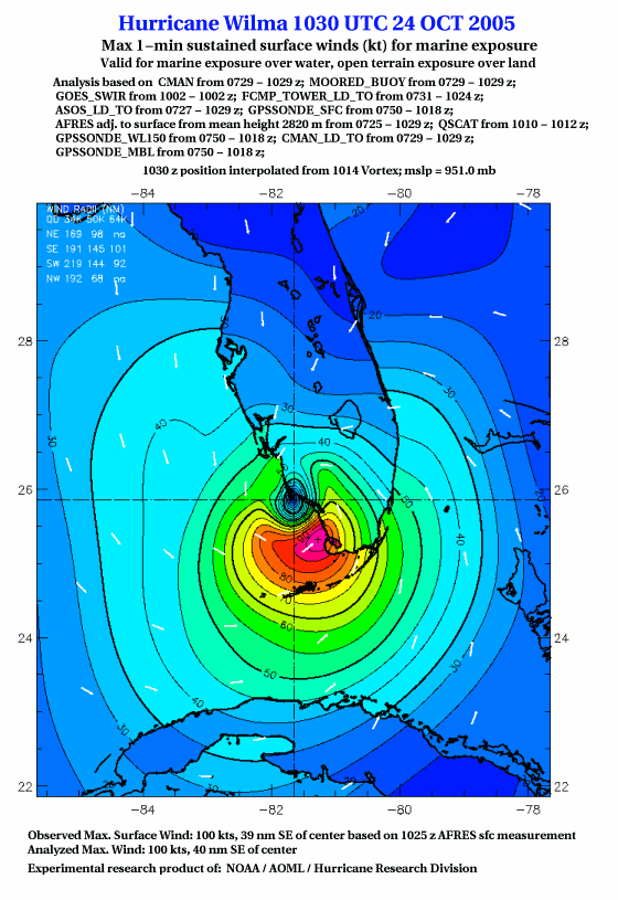
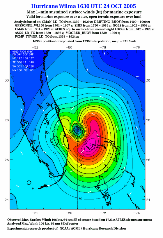
From the maps below it appears that Wilma had maximum sustained winds of over 100 knots/ 115 mph at landfall and over 105 knots /120 mph after it emerged from crossing Florida. These are winds sustained over one minute; gusts of a few seconds duration could be much higher (see further discussion below). This suggests that a significant area of Florida was affected by a strong category two hurricane (see this page for Safford-Simpson scale points). The maps show the strongest winds were south of the eye, but given the large eye with changing conditions around it, it is hard to say exactly where those strongest winds were. A wind tower near FIU's University Park Campus (T3 on map below) deployed for the Florida Coastal Monitoring Program recorded a 69 mph one-minute wind at 10:11 am and a 96 mph three-second gust at 9:46 am. Some other areas probably had stronger winds.

