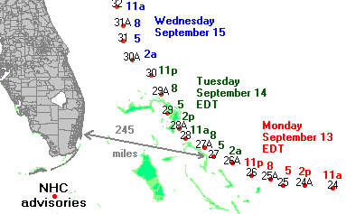
Floyd
track and NHC advisories
|
On Monday September 13 Hurricane Floyd
approached the Bahamas and Florida. Its
track took it to the central Bahamas the next
day. The strength and size of the hurricane
meant when it was in the central Bahamas, the
coast of Florida could be experiencing
tropical storm force winds (extending 290
miles from the center of the hurricane). On
Monday, with 155 mph winds and 921 mb
pressure Floyd was on the verge of becoming a
category 5 hurricane. Forecast models and
the National Hurricane Center advisories were
predicting a turn to the north as it
approached the Florida coast.
Monday was the day of decision for south
Florida residents because tropical storm
force winds could be making evacuation
difficult or impossible by Tuesday. North
Florida residents had to make their decisions
by Tuesday for the same reason.
|
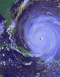
click to enlarge (491 Kbytes)
AVHRR
satellite image
Monday Sept. 13, 4:40 pm
edt, corresponds to NHC advisory 25
|
For south Florida the big question Monday
was when and if Floyd would make its turn to
the north. During the day the forecasts and
models were consistent in saying the turn
would take place, but as the day went on the
possibility grew for a brush with the coast
even if the turn took place. By 11 pm on
Monday the turn still had not happened, and
forecasters were expressing some concern that
the size of the storm may have been making
model predictions less accurate. By that
time, however, it was too late for most
people to begin evacuation. Fortunately (for
Florida) the forecasts and models were
correct and by 5 am Tuesday the turn in a
more northward direction had taken place.
Nonetheless, large numbers of people in South
Florida did evacuate. For Miami-Dade County
the FIU/Florida Poll estimates are that
57,743 (±3.7%) households evacuated.
In Miami-Dade there are about 80,000
households on beach islands and other areas
called to evacuate. Since only 11 people in
the survey from Miami-Dade did evacuate it is
not possible to estimate how many of the
evacuating households were on coastal islands
as opposed to being in trailer parks or other
areas. A map of
zip code locations does suggest that a good
percentage could have been inland.
Evacuation traffic on major highways in south
Florida was less of a problem than in the
north since, as noted elswhere on this site
south Florida residents more than north
tended to go to other homes in the same area.
|
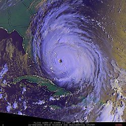
click to enlarge (609 Kbytes)
AVHRR
satellite image
Tuesday Sept. 14, 8:51 am
edt, corresponds to NHC advisory 27A
|
During the day Tuesday south Florida
could breath a sigh of relief but the
situation was more risky to the north as
Floyd remained a very strong and large storm.
Furthermore, some models were predicting a
path very close to the shore: "... central
Florida northward becomes even more
vulnerable to experience the westward portion
of the eyewall. Only a small deviation to
the left would bring the eye to the coast."
(Discussion from NHC advisory 28, 11 am
Tuesday). Evacuations were being completed.
Many more people evacuated in the north and
many more went to distant destinations,
resulting in traffic problems on major
highways. |
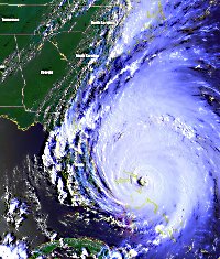
click to enlarge (865 Kbytes)
AVHRR
satellite image
Tuesday Sept. 13, 4:31 pm
edt, corresponds to NHC advisory
29
|
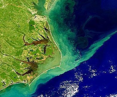
Florida was spared the wrath of
Floyd. North Carolina was not so lucky, learning
like Honduras and Nicaragua in Mitch that inland
flooding can be as dangerous as wind and coastal
surge and much harder to predict. |


 IPOR
Home Page
