GladwinMaps.pdf

Project Area Map
GladwinMaps.pdf
Project Area Map
GIS data files (zipped -- right click to download)
QGISformat.zip
ESRIformat.zip
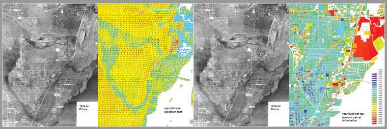
1924_airphotos.jpg
1924 area montage from aerial photos taken over Miami, see http://miamiultra.fiu.edu/environmental-history/aerial-photography/
-- this in GIS files is only approximately georeferenced -- use FEC rail to note alignment
ElevationFeetCurrent.jpg
elevation data from
SFWMD GIS:
South Florida Composite
Topography, 50-ft DEM,
rev. 1, 2014
http://www.sfwmd.gov/gisapps/sfwmdxwebdc/dataview.asp?query=unq_id=2483
YearBuiltMap.jpg
Year built information from tax roll and GIS data at
http://dor.myflorida.com/dor/property/resources/data.html
Some background coverages (rail lines, carto streets) from Miami-Dade Open Data Hub
Thelma Peters Biscayne country, 1870-1926
http://www.amazon.com/Biscayne-country-1870-1926-Thelma-Peters/dp/0916224651
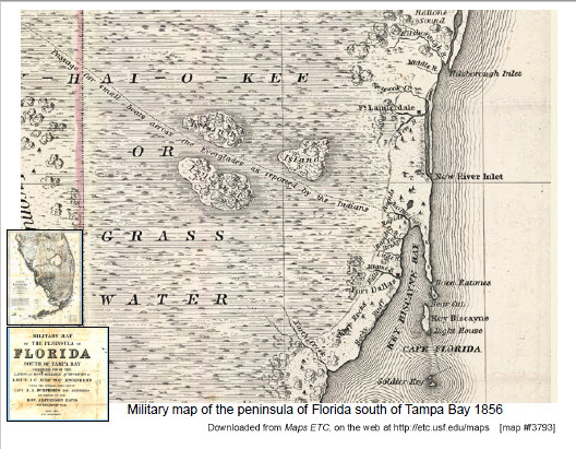
This map (click to enlarge) gives evidence of the water level (indicated by canoe trails) prior to drainage. Arch Creek, the current location of the study area, is marked on the map.
excerpt from Military map of the peninsula of Florida 1856
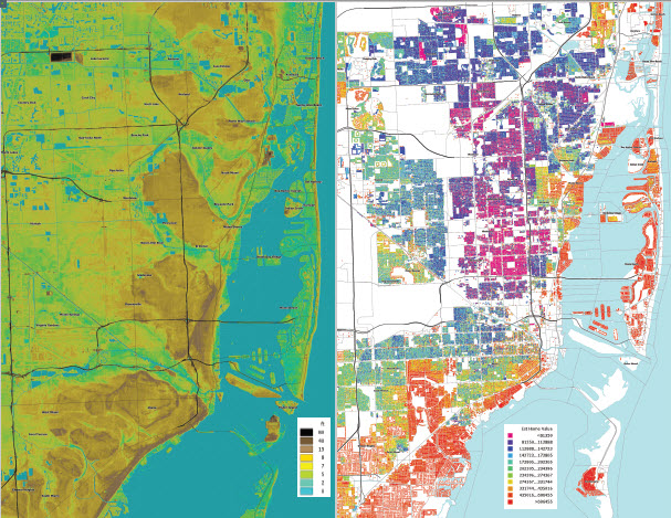
The maps below were prepared in conjunction with my research methods class. In the elevation map on the left one can see with darker brown higher elevation the northern extension of the "Everglades Keys" where people could settle prior to canal drainage culminating in the 1920's. On the right current housing values (own-owned homes only) shows persisting housing values indicating which of these "Keys" became successful high-value developments and which largely became part of the poorer urban core.
ElevationHousingMapData.pdf
Image sources Illustrator files zipped
AdobeIllustratorfiles.zip